

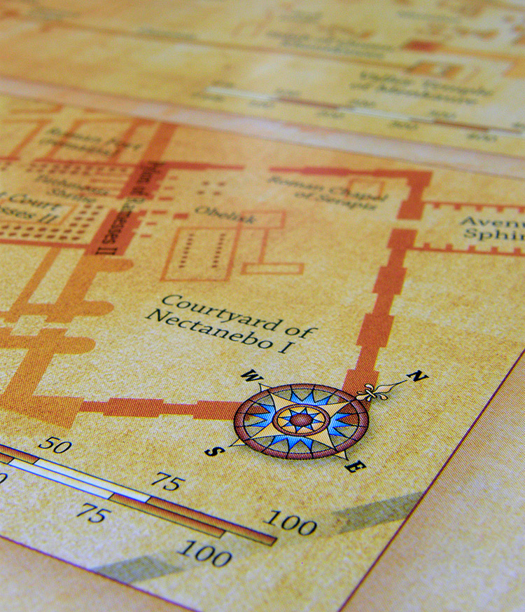
Ancient Egypt Map
A2 - 420mm x 594mm / 16.5" x 23.4"
Ancient Egypt: Sites and Settlements of the Dynastic Period
- Features:
- • A2 Print
- • Dimensions: 420mm x 594mm / 16.5" x 23.4"
- • Printed on 150gsm silk paper
- • Supplied rolled and packaged in a postage tube
- • Shipped worldwide

UK postage
£20.00 GBP each (postage and packing included)
European shipping (EU)
€28.00 EUR each (postage and packing included)
Worldwide shipping
$35.00 USD each (postage and packing included)
This presentation map, printed on a durable 150gsm silk paper, highlights the key sites and settlements of Ancient Egypt. A custom designed map print that is suitable for direct display or framing, this map is an ideal educational display resource. The main map provides an overview of Ancient Egypt during the dynastic period and features a large number of key landmarks. The print also incorporates a series of inset maps that focus upon some of Ancient Egypt's best known locations. These sites include the Pyramids at Giza, Karnak Temple Complex, Abusir Necropolis and Luxor Temple. With a coverage that extends as far south as the regions of Nubia and Kush, this map uses creative textures, to create a more distinctive appearance. Also noted on this map are the principal agricultural locations and the sites most extensively exploited by the Ancient Egyptians for their natural resources. This map is ideal for classroom display or for use at home by children learning about Ancient Egypt.

London Map
A0 - 1189mm x 841mm / 46.8" x 33.1"
A map of Greater London, highlighting specific points of interest.
- Features:
- • A0 Print
- • Dimensions: 1189mm x 841mm / 46.8" x 33.1"
- • Printed on 130gsm gloss paper
- • Supplied rolled and packaged in a postage tube
- • Shipped worldwide
UK postage
£25.00 GBP each (postage and packing included)
European shipping (EU)
€35.00 EUR each (postage and packing included)
Worldwide shipping
$50.00 USD each (postage and packing included)
A large format map of Greater London, produced for wall display. This is our map of Greater London customised to highlight tourist attractions and other specific points of interest. This map has been designed at a scale that makes it suitable for framing and display. If required, we can also customise this map to include the features that are important to you or your organisation. Built with information derived from the OpenStreetMap project and Ordnance Survey's OpenData, this up-to-date map shows the location of London's most popular tourist attractions, places of interest, historic buildings, transport links and other amenities.

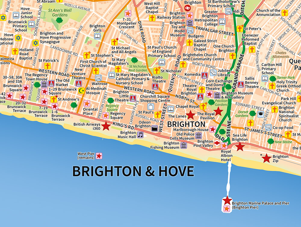
Brighton & Hove Map
A1 - 841mm x 594mm / 33.1" x 23.4"
Brighton & Hove, Portslade-by-Sea and Southwick
- Features:
- • A1 Print
- • Dimensions: 841mm x 594mm / 33.1" x 23.4"
- • Printed on 130gsm gloss paper
- • Supplied rolled and packaged in a postage tube
- • Shipped worldwide
UK postage
£25.00 GBP each (postage and packing included)
European shipping (EU)
€35.00 EUR each (postage and packing included)
Worldwide shipping
$50.00 USD each (postage and packing included)
A large format map of Brighton, produced for wall display. This is our map of Brighton & Hove, Portslade-by-Sea & Southwick, customised to highlight a selection of specific locations. Built with information derived from the OpenStreetMap project and Ordnance Survey's OpenData, this map shows the location of Brighton's most popular tourist attractions and points of interest, parks and gardens, museums, schools and places of worship. Also included are the region's Grade I and Grade II* listed buildings and churches.